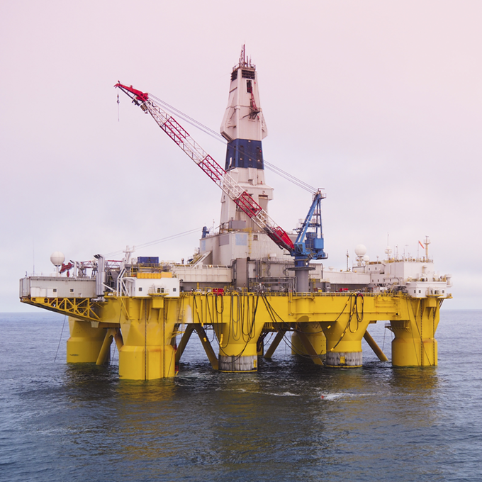

Overview
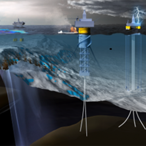
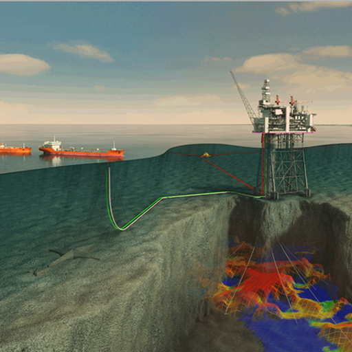
Strong metocean conditions, such as extreme ocean currents and natural shifts in the ocean seabed, can have a significant impact on the integrity and longevity of offshore infrastructure. Changes in the ocean environment, such as submarine landslides, can be triggered by strong weather events (e.g., hurricanes) as well as the natural fluctuations in the system over time. These changes can impact safe operations and use of offshore infrastructure, and metocean events to date have been linked to billions of dollars in damage and environmental and community impacts. As a result, the ever-shifting offshore environment introduces a currently unquantified level of risk and vulnerabilities to a range of offshore energy activities.
This project will leverage historic metocean and bathymetric conditions to develop a new smart technology that will help identify current hazardous metocean and bathymetric conditions, as well as forecast changes and potential vulnerabilities that may affect existing or future offshore infrastructure and activities. The result will be an artificial intelligence/machine learning (AI/ML) and probabilistic smart tool that advances the current state of knowledge of ocean and seabed conditions and offshore hazards. This smart tool will offer insights to improve infrastructure longevity and support the identification of seabed and shallow subsurface hazards, thus mitigating environmental impacts, reducing costs, and improving safety during engineered-natural system energy activities.
Approach
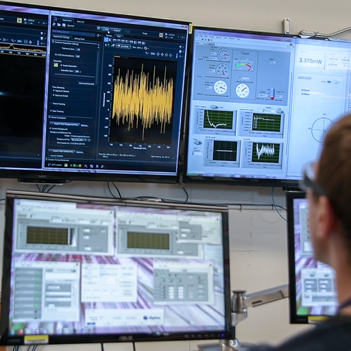
To successfully develop, train, test, and validate a smart tool requires a significant volume, and often velocity, of data to support the analytics. However, the multi-variate, multi-dimensional, and often restricted nature of metocean and bathymetric data has limited the ability of researchers to support these robust analytics until more recently due to the development and broad application of new sensors, sonars, and big data processing techniques.
This project will facilitate the development, training, testing, and validation of a smart technology that uses historic observations of metocean and bathymetric data to identify current hazardous metocean and bathymetric conditions, as well as forecast changes and potential vulnerabilities that may impact existing or future offshore infrastructure. The smart technology will integrate AI/ML, spatio-statistical, and probabilistic analyses, where appropriate, to accelerate analyses and provide insight into potentially hazardous conditions.
Year 1 research focused on proving the concept — that sufficient, detailed historic data are available to support the development of an analytical framework that uses advanced analytics (such as machine learning, artificial intelligence, and big data capabilities) to forecast and predict metocean and bathymetric hazards and vulnerabilities. In Year 2, the smart tool framework, known as the Ocean & Geohazard Analysis (OGA) tool, was developed, and multiple AI/ML and/or probabilistic analytical models for corresponding metocean and seabed hazard conditions were developed to predict vulnerabilities. Year 3 will focus on validating and refining the analytical logic and interactive, online tool based off input from internal and external stakeholders. Moving into Year 4, we will continue to optimize the OGA tool and publicly release an integrated metocean and seabed hazard database.
Expected Outcome
This project will result in a smart, interactive, online tool to predict potential metocean and bathymetric hazards and vulnerabilities in relation to improving infrastructure longevity, shallow hazard reduction,
and offshore energy activities. The tool will operate as a plug-in application within EDX®’s Geocube, enabling the ability to perform near-real time assessments of current hazards and the support of forecasting areas with higher vulnerabilities. In addition to the tool, key analytical results will also be made available as interactive map layers. Together, this tool and information will aid in the reduction of potential risks to daily offshore activities including carbon storage and offshore wind/wave energy in the future.
Research Products
Research products are being developed and will be posted here as updates when publicly available.
On the Predictability of Loop Current Eddy Shedding Events and Unexpected Links to the Brazil and Guiana Currents
Duran R., S. X. Liang, M. E. Allende Arandia and C. M. Appendini 2021. “On the Predictability of Loop Current Eddy Shedding Events and Unexpected Links to the Brazil and Guiana Currents,” AGU Fall Meeting 2021, Dec. 13-17, New Orleans, LA/Virtual.
Exploring the Spatial Variations of Stressors Impacting Platform Removal in the Northern Gulf of Mexico
Nelson, J.R., Romeo, R., and Duran, R., 2021. “Exploring the Spatial Variations of Stressors Impacting Platform Removal in the Northern Gulf of Mexico,” Journal of Marine Science and Engineering 9, no. 11: 1223. https://doi.org/10.3390/jmse9111223
On the Advection of Upwelled Water on the Western Yucatan Shelf
Kurczyn JA., Duran R., Beier E., and Souza AJ., (2021) On the Advection of Upwelled Water on the Western Yucatan Shelf. Front. Mar. Sci. 8:723452. doi: 10.3389/fmars.2021.723452
Seafloor Landslide Detection in the Gulf of Mexico Using Computer Vision
Zaengle, D., Dyer, A., Duran, R., Mark-Moser, M., Rose, K., Bauer, J., Wingo, P., “Seafloor Landslide Detection in the Gulf of Mexico Using Computer Vision,” IMAGE 2021, Sep. 26- Oct. 1
Baseline data for spill assessments: Ambient conditions, Socioeconomic data, Sensitivity maps
Romeo, L., Wingo, P., Sabbatino, M., Bauer, J. (2021). Baseline data for spill assessments: Ambient conditions, Socioeconomic data, Sensitivity maps. In O. Makarynskyy (Ed.), Marine Hydrocarbon Spill Assessment: From Baseline Information through to Decision Support Tools (1 ed.). Amsterdam, Netherlands: Elsevier. https://doi.org/10.1016/B978-0-12-819354-9.00007-7
Vertical Transport in Oil Spill Modeling
Nordam T., J. Skancke, R. Duran and C. Barker (in press, 2021). Vertical transport in oil spill modeling. Book chapter in MarineHydrocarbon Spill Assessments, Elsevier. https://arxiv.org/abs/2010.11890
Horizontal Transport in Oil-Spill Modeling
Duran, R., T. Nordam, M. Serra and C. Barker (in press, 2021). Horizontal transport in oil-spill modeling. Book chapter in Marine Hydrocarbon Spill Assessments, Elsevier. https://arxiv.org/abs/2009.12954
Geohazard Analysis of Seafloor Landslide Potential for Infrastructure Protection
Dyer, A., Duran, R., Mark-Moser, M., Rose, K., Bauer, J., Zaengle. D., Wingo, P. 2021. “Geohazard Analysis of Seafloor Landslide Potential for Infrastructure Protection,” Esri User Conference. July 12-16, 2021
Persistent meanders and eddies lead to quasi-steady Lagrangian transport patterns in a weak western boundary current
Gouveia, M. B., R. Duran, J. A. Lorenzzetti, A. T. Assireu, R. Toste, L. P. de F. Assad and D. F. M. Gherardi (2021). Persistent meanders and eddies lead to quasisteady Lagrangian transport patterns in a weak western boundary current. Scientific Reports, 11(1), 497.
https://www.nature.com/articles/s41598-020-79386-9
Developing a Structured Seafloor Sediment Database from Disparate Datasets using SmartSearch
Mark-Moser, M., Rose, K., Baker, V. D. 2020. “Developing a Structured Seafloor Sediment Database from Disparate Datasets using SmartSearch,” AGU Annual Fall Meeting (Virtual), 2020. https://www.osti.gov/servlets/purl/1776797
Deep Learning to Locate Seafloor Landslides in High Resolution Bathymetry
Dyer, A., Zaengle, D., Mark-Moser, M., Duran, R., Bauer, J., Rose, K., 2020. “Deep Learning to Locate Seafloor Landslides in High Resolution Bathymetry,” AGU Annual Fall Meeting (Virtual), 2020. https://www.osti.gov/servlets/purl/1779617
A Geospatial Analytical Framework to Identify Seafloor Geohazards in the Northern Gulf of Mexico
Duran, R., Dyer, A., Mark-Moser, M., Bauer, J., Rose, K., Zaengle, D., Wingo, P. 2020. “A Geospatial Analytical Framework to Identify Seafloor Geohazards in the Northern Gulf of Mexico,” AGU Annual Meeting 2020, Session: NH010 -Geohazards in Marine and Lacustrine Environments
Numerical Integrators for Lagrangian Oceanography
Nordam, T. & R. Duran (2020). Numerical integrators for Lagrangian oceanography. Geoscientific Model Development, 13, 5935–5957. https://doi.org/10.5194/gmd-13-5935-2020.
Evaluating Offshore Infrastructure Integrity
Nelson, J., Dyer, A., Romeo, L., Wenzlick, M., Zaengle, D., Duran, R., Sabbatino, M., Wingo, P., Barkhurst, A., Rose, K., Bauer, J. Evaluating Offshore Infrastructure Integrity; DOE/NETL-2021/2643; NETL Technical Report Series; U.S. Department of Energy, National Energy Technology Laboratory: Albany, OR, 2020; p 70. doi.org/10.2172/1780656
Environmental Economics and Uncertainty Review and a Machine Learning Outlook
Zhang, R., Wingo, P., Duran, R., Rose, K., Bauer, J., and Ghanem, R., “Environmental Economics and Uncertainty Review and a Machine Learning Outlook,” Oxford Encyclopedia of Environmental Economics (April 23, 2020). Available at SSRN: https://ssrn.com/abstract=3583911.
Building an Analytical Framework to Measure Offshore Infrastructure Integrity, Identify Risk, and Strategize Future Use for Oil and Gas
Dyer, A., Rose, K., Bauer, J., Romeo, L., Barkhurst, A., Wingo, P., Sabbatino, M., Nelson, J., and Wenzlick, M., “Building an Analytical Framework to Measure Offshore Infrastructure Integrity, Identify Risk, and Strategize Future Use for Oil and Gas,” AGU Ocean Sciences, February 2020, https://www.agu.org/Ocean-Sciences-Meeting.
Data-Driven Risk Assessment of Drilling in the Gulf of Mexico
Zhang, R., Wingo, P., Duran, R., Rose, K., Bauer, J., and Ghanem, R., “Data-Driven Risk Assessment of Drilling in the Gulf of Mexico,” accepted for publication in the Oxford Encyclopedia of Environmental Economics.
Connectivity of the Deep Waters in the Gulf of Mexico
Maslo et al., “Connectivity of the Deep Waters in the Gulf of Mexico,” Journal of Marine Systems (2019)
https://doi.org/10.1016/j.jmarsys.2019.103267
Physical Oceanography and Meteorology of the Gulf of Mexico: Aspects Relevant to the Offshore Industry
Duran, R., “Physical Oceanography and Meteorology of the Gulf of Mexico: Aspects Relevant to the Offshore Industry,” in preparation, NETL-TRS-X-2019, EPAct Technical Report Series, U.S. Department of Energy, National Energy Technology Laboratory, Albany, OR, 2019, p. XX.
CIAM Climatological Isolation and Attraction Model–Climatological Lagrangian Coherent Structures
Duran, R., Beron-Vera, F.J., and Olascoaga, M.J., “CIAM Climatological Isolation and Attraction Model–Climatological Lagrangian Coherent Structures,” (2019), https://doi.org/10.18141/1558781, DOI: 10.18141/1558781.
Persistent Lagrangian Transport Patterns in the Northwestern Gulf of Mexico
Gough, M.K., Beron-Vera, F.J., Olascoaga, M.J., Sheinbaum, J., Jouanno, J., and Duran, R., “Persistent Lagrangian Transport Patterns in the Northwestern Gulf of Mexico,” Journal of Physical Oceanography, 49 (2019), 353–367, https://doi.org/10.1175/JPO-D-17-0207.1.
Simulation of the 2003 Foss Barge – Point Wells Oil Spill: A Comparison between BLOSOM and GNOME oil-spill models
Duran, R., L. Romeo, J. Whiting, J. Vielma, K. Rose, A. Bunn, J. Bauer (2018). Simulation of the 2003 Foss Barge – Point Wells Oil Spill: A Comparison between BLOSOM and GNOME oil-spill models. J. Mar. Sci. Eng., 6(3), 104; https://doi.org/10.3390/jmse6030104
Extracting Quasi-Steady Lagrangian Transport Patterns from the Ocean Circulation an Application to the Gulf of Mexico
Duran, R., Beron-Vera, F.J., and Olascoaga, M.J., “Extracting Quasi-Steady Lagrangian Transport Patterns from the Ocean Circulation an Application to the Gulf of Mexico,” Scientific Reports, 8, 10 (2018), DOI: 10.1038/s41598-018-23121-y, https://doi.org/10.1038/s41598-018-23121-y.
Analysis Of How Environmental Conditions Affect Dispersant Performance During Deep Ocean Application
G.T. Bonheyo, K. Rose, A. Bunn, A. Avila, T. Bays, V. Cullinan, R. Duran, R. Jeters, L-J. Kuo, J. Park, J. Vielma, E.Winder, P.Wingo (2017). Analysis Of How Environmental Conditions Affect Dispersant Performance During Deep Ocean Application. PNNL-26935. Bureau of Safety and Environmental Enforcement, Washington, DC. p 173. https://www.bsee.gov/research-record/osrr-1066-analysis-how-environmental-conditions-affect-dispersant-performance-during
BLOwout and Spill Occurrence Model (BLOSOM)
Sim, L., Vielma, J., Duran, R., Romeo, R., Wingo, P., and Rose, K. (2017). BLOwout and Spill Occurrence Model (BLOSOM).
https://edx.netl.doe.gov/dataset/blosom-release DOI: 10.18141/1420083
Explore research products that are related to this project.

Figure 1. CIIAM outputs for ocean current trajectory showing how tracers representing hazmat material would deform under the influence of ocean currents in the Gulf of Mexico.

Figure 2. Predicted seafloor landslide potential in the northern Gulf of Mexico using spatial risk-based analysis.

Figure 3. Predicted seafloor landslide potential in the northern Gulf of Mexico using AI/ML-informed analysis.

Figure 4. Automated landslide detection results from a data-driven neural network analysis of northern Gulf of Mexico bathymetry. Recent results (left) show the two output layers of the network (bottom C, D) which are combined to create the prediction mask (A) with the ground truth (B) for comparison.

Figure 5. Temporal variability of sea-surface velocity obtained objectively through self-organizing maps, from the western equatorial Atlantic to the Gulf of Mexico, showing a seasonal cycle in the region where Loop Current eddy separation initiates.
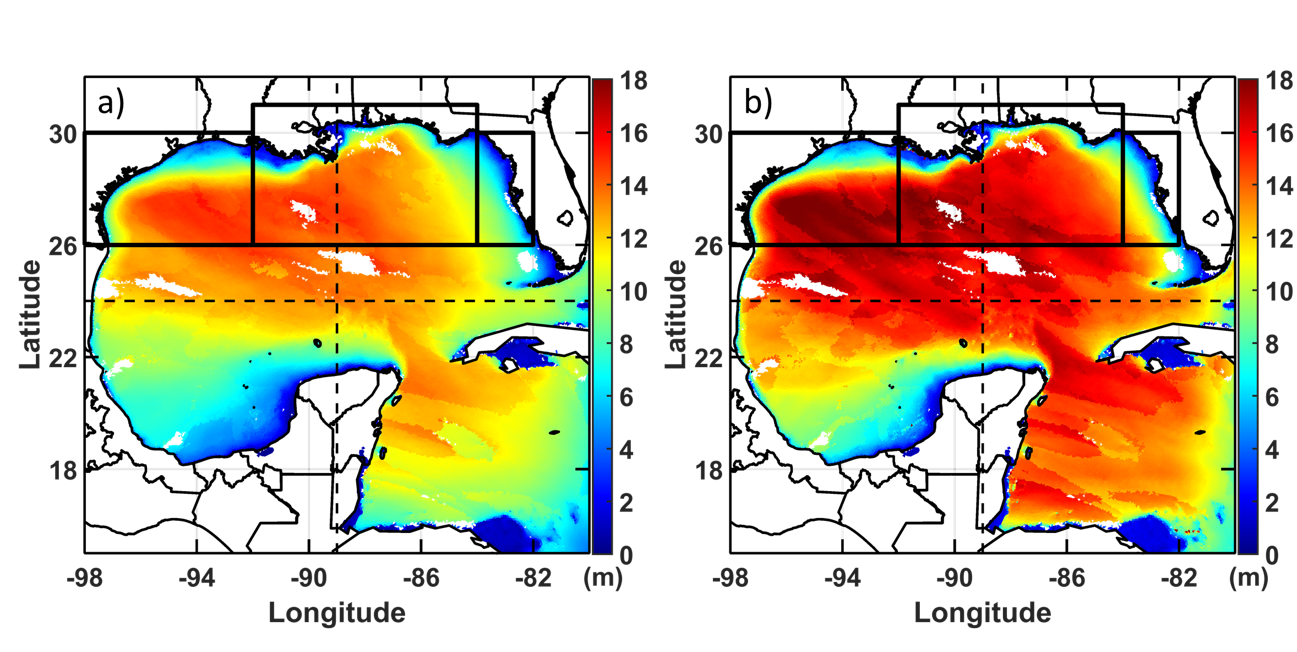
Figure 6. Significant wave height for the 100-years return period obtained from physics-based modeling of the GCM derived events ensemble for the (a) present and (b) future wave climates. Blank areas denote regions where less than 4 models show the same trend.
Contacts
Jennifer Bauer
Co-Principal Investigator
Rodrigo Duran
Research Applied Mathematician/Oceanographer
Co-Principal Investigator
MacKenzie Mark-Moser
Research Geologist
Co-Principal Investigator
Kelly Rose
Offshore Portfolio Lead
Roy Long
Offshore Portfolio Technical Manager
Effective Resource Development
Alexandra Hakala
Senior Fellow (Detail)
Geological & Environmental Systems
Philip Reppert
Associate Director
Geological & Environmental Systems