


BLOSOM is NETL’s comprehensive modeling suite for offshore blowout events, adapted for jet/plume behavior, high pressures, gas and hydrate dynamics, droplet-size distributions, and subsurface plume formation.
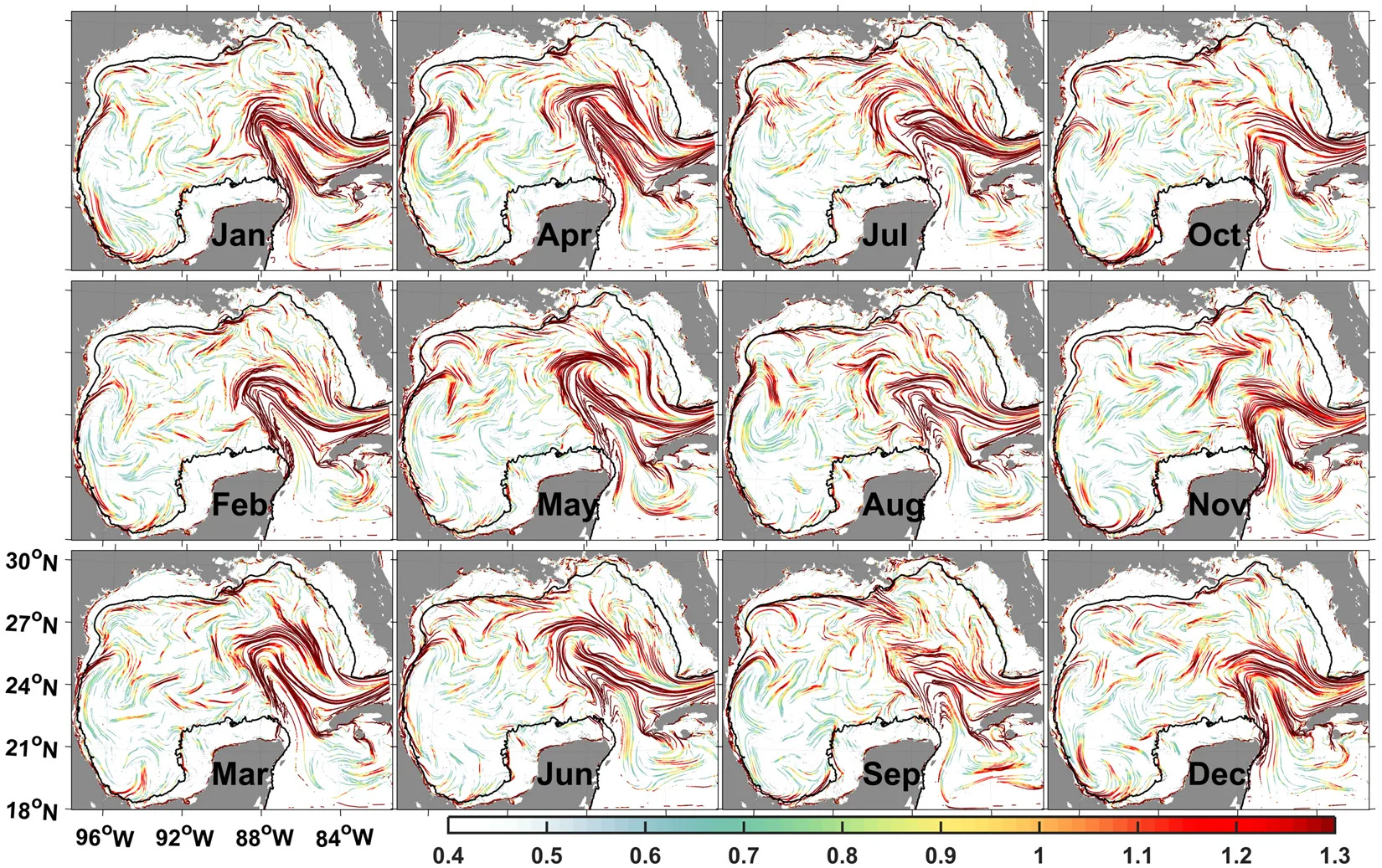
CIAM Climatological Isolation and Attraction Model–Climatological Lagrangian Coherent Structures: Matlab code to compute climatological Lagrangian Coherent Structures. Climatological Lagrangian Coherent Structures have been shown to be effective in identifying regions that persistently attract or isolate trajectories at the sea surface, while also identifying recurrent transport patterns and transport barriers. It is therefore known as the Climatological Isolation and Attraction Model within NETL DOE.
Cumulative Spatial Impact Layers (CSIL) is a GIS-based tool that summarizes spatio-temporal datasets based on overlapping features and attributes. Applying a recursive quadtree method and multiple additive frameworks, the CSIL tool allows users to analyze raster and vector datasets simultaneously by calculating data, record, or attribute density.
Energy Data Exchange is a tool to support coordination and collaboration across research efforts that require a common set of information related to subsurface energy resources.

NETL’s GOM Geocube focuses on the offshore Gulf of Mexico region. NETL’s Geocube is a flexible, customizable web mapping application that concatenates key spatial datasets and information relevant to energy research needs for a given region.

GeoWELL is a map-based application providing quick access to subsurface geologic and wellbore information primary source websites for state, tribal, and federal agencies.
NETL’s Variable Grid Method (VGM) is a novel tool that visualizes spatial data and uncertainty simultaneously, allowing users to create data-driven variable grids — customized to best fit their data, analyses, and uncertainty — to help communicate and quantify spatial data in an intuitive manner.


