-
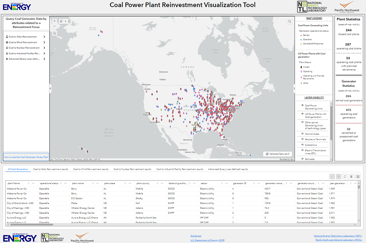
Geospatial NETLThis tool, available at https://energycommunities.gov/coal-power-plant-reinvestment-visualization-tool/, serves as a public database and map for the purposes of enabling state...
-
Dataset Size: 0 bytes
Resource List
View within Submission Gathering Resources...
 -
-
AI/ML Geospatial NETLThe Advanced Infrastructure Integrity Model (AIIM) is a multivariate, multi-machine learning modeling technology applied to evaluate the integrity of offshore energy...
-
Dataset Size: 0 bytes
Resource List
View within Submission
Gathering Resources... -
-
Geospatial NETLData, geospatial data resources, and the linked mapping tool and web services reflect data for two types of potentially qualifying energy communities: 1) Census tracts and...
-
Dataset Size: 231.811 MB
Resource List
View within Submission
Gathering Resources... -
-
Geospatial NETLThe Mapping Inquiry Tool (MapIT) database consists of a geodatabase and data catalog of geologic, geophysical, structural, hydrologic, and contextual data, based on the data...
-
Dataset Size: 23.385 GB
Resource List
View within Submission
Gathering Resources... -